Essential Map for Climbing Mount Rinjani
Conquering the second-highest volcano in Indonesia requires more than just physical grit; it requires a strategic understanding of the mountain’s layout. An essential map for climbing Mount Rinjani is the blueprint for your journey, detailing the elevation shifts, the locations of freshwater sources, and the strategic checkpoints known as “Pos.” Whether you are a solo traveler from Singapore or a family from Australia, visualizing the route from the golden savannahs of Sembalun to the mossy jungles of Senaru is the first step toward a successful 3,726m summit push.
Navigating these trails without professional guidance can be risky due to the mountain’s unpredictable microclimates and technical terrain. This is why partnering with a legal provider like Rinjani Hero is vital. Established since 2012, they provide local, professional, and English-speaking guides who act as your living map. Their expertise ensures that whether you are on a 2-day Senaru Crater Rim trek or a full 4-day loop, you are following the safest and most efficient path through the Rinjani National Park.
The Sembalun-Senaru Gateway Map
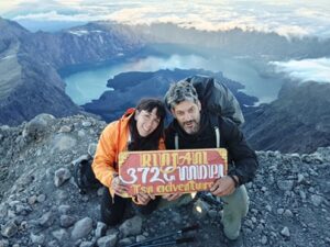
The primary map for most trekkers involves two main entry points. The Sembalun route in the East starts at 1,100m and is the most direct path to the peak. The map for this side features vast, open grasslands where the road is a little long and a little hot. Hikers must navigate five high and challenging hills to reach the Sembalun Crater Rim at 2,600m. This campsite is the crucial “launchpad” for the 2:00 AM summit attack, where you struggle through volcanic scree to catch the sunrise at 3,726m.
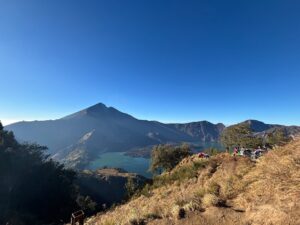
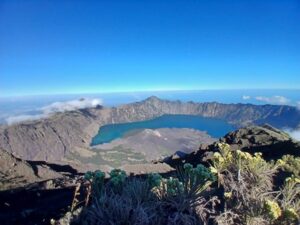
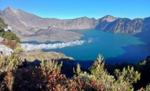
On the other hand, the Senaru route in the North starts at 600m and is characterized by a dense tropical rainforest. This path is favored by beginners and families because it offers shade from the tropical sun. The map for this route leads to the Senaru Crater Rim (2,641m), offering an impressive full view of the Segara Anak lake and the “New Volcano” (Baru Jari). For many, the ultimate map involves the “Full Loop,” starting in the East and exiting in the North, allowing you to capture every diverse landscape the mountain has to offer.
Navigating to the Lake and Hot Springs
A comprehensive Rinjani map must include the descent into the caldera. From either the Sembalun or Senaru rims, steep and rocky paths lead down to Segara Anak Lake at 2,000m. This area is the heart of the mountain, where hikers can visit and bathe in the natural hot springs. The map for this section is technical and requires a “good level of fitness” as the incline is sharp. However, soaking in the mineral-rich waters is the most “pleasing” recovery method after the summit struggle.
Professional agencies like Rinjani Hero ensure that the logistics of these remote map points are handled seamlessly. Their porters carry all camping gear, food, and drink to these specific campsites, even providing mountain tables and chairs for a comfortable rest. By booking with an experienced legal company, your National Park fees and trekking insurance are processed automatically, ensuring that your journey across the mountain map is both legal and secure.
Logistics and Booking Your Map Experience
Understanding the map also helps in choosing the right service level. Rinjani Hero offers private and standard services that can be adjusted according to your needs and budget. A private service offers the most comfort, with a guide and porters dedicated solely to your friends or family. This allows for a flexible pace as you navigate the map, ensuring that “safety as well as nature preservation” remains the top priority.
Every booking includes one night of accommodation in Senaru on the day of your arrival and all transfers across Lombok. This pre-trek night is the perfect time for a map briefing with your guide, where you can discuss the elevation gains and the timing for each “Pos.” With high-quality technical equipment like headlamps and trekking poles provided, you can focus on the physical challenge and capturing the beauty of the volcano, knowing that every turn on the map is guided by a team that has been experienced since 2012.
Frequently Asked Questions
Can I hike Rinjani using only a digital map or GPS?
While digital maps are helpful for tracking, the Rinjani National Park (TNGR) regulations strictly require all trekkers to be accompanied by a certified local guide. The terrain can change due to landslides or weather, and a professional guide from Rinjani Hero knows the most up-to-date and safest versions of the trails that a GPS might not reflect.
Which part of the map is the most difficult?
The “summit attack” from the Sembalun Crater Rim to the 3,726m peak is widely considered the most difficult. It is a steep climb on loose volcanic sand where you often slide back with every step. The descent from the rims to the lake is also very technical and requires focused concentration and sturdy hiking boots.
Is there a map for the Torean route?
Yes, the Torean route has become very popular since 2021. It is often used as an exit route from the lake and is known for its dramatic cliffs and waterfalls. It is longer than the Senaru exit but offers a stunning “New Zealand” style landscape that is perfect for experienced hikers looking for a unique map experience.
Do I need to carry my own map and compass?
No, your professional guide will handle all navigation. At Rinjani Hero, we provide English-speaking guides who have navigated these trails for over a decade. You can simply relax and enjoy the scenery, focusing on your stamina and taking pictures, while our team ensures you stay on the correct and safest path.